
Today will be consumed by just the one activity, we are heading down to the south coast of the island, somewhere we have never visited before. So today will be Black beaches, Volcanoes, Glaciers and Waterfalls. We’ve been looking forward to this one.
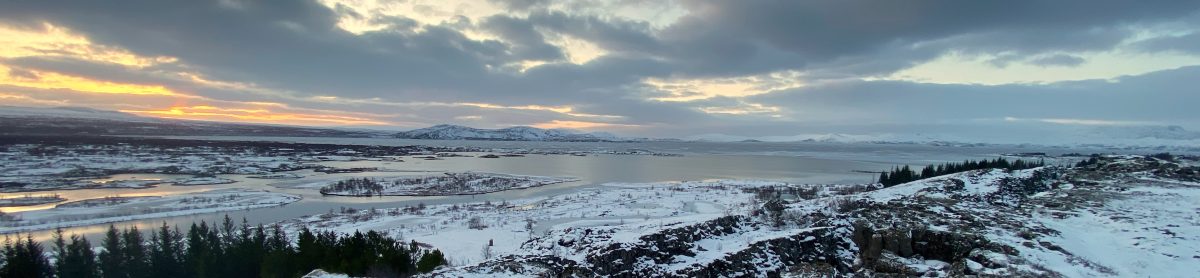
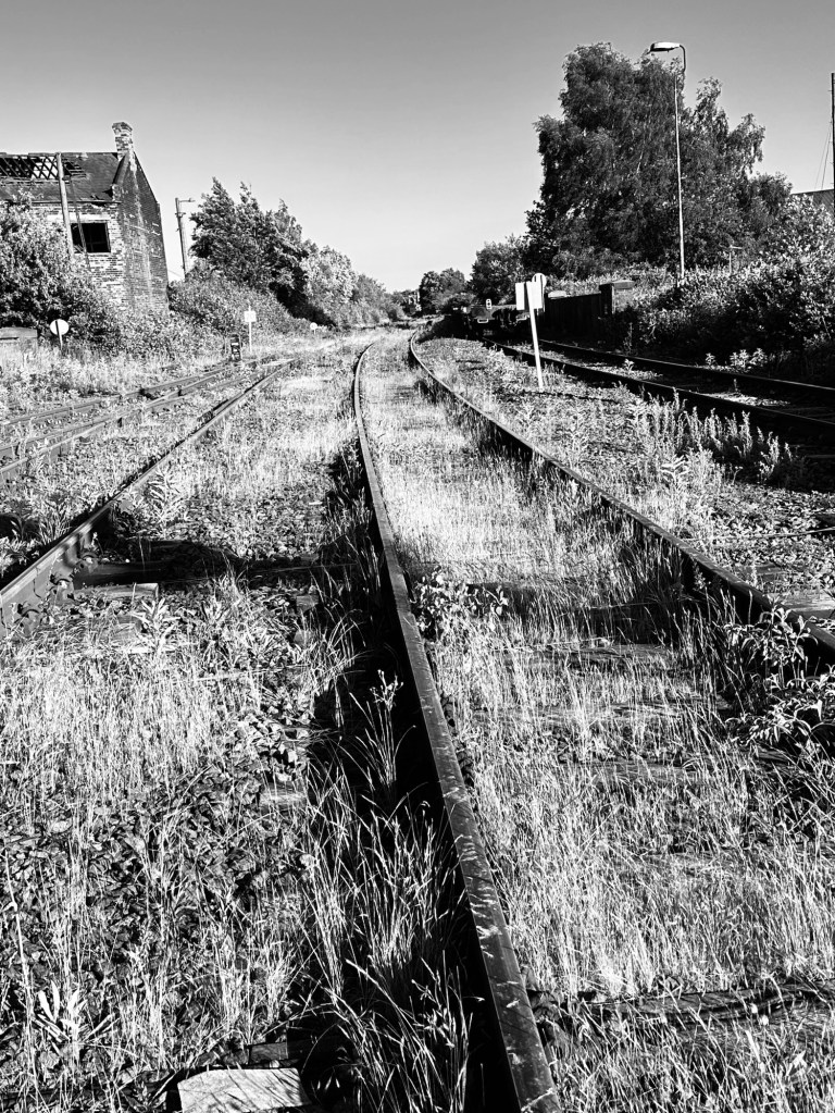
On our way we passed the volcano Nick named by those who struggle with the Icelandic language as E15. Why E15? Well it began with the letter “E” and has 15 other letters after it that’s why! Its proper name is Eyjafjallajökull, you will know of it, as it was the one the erupted in 2010 causing all the disruption to European airspace as its massive cloud blanketed Europe. It looked so serene from the bus as we passed by on our journey south.
Eyjafjallajökull from the route one road
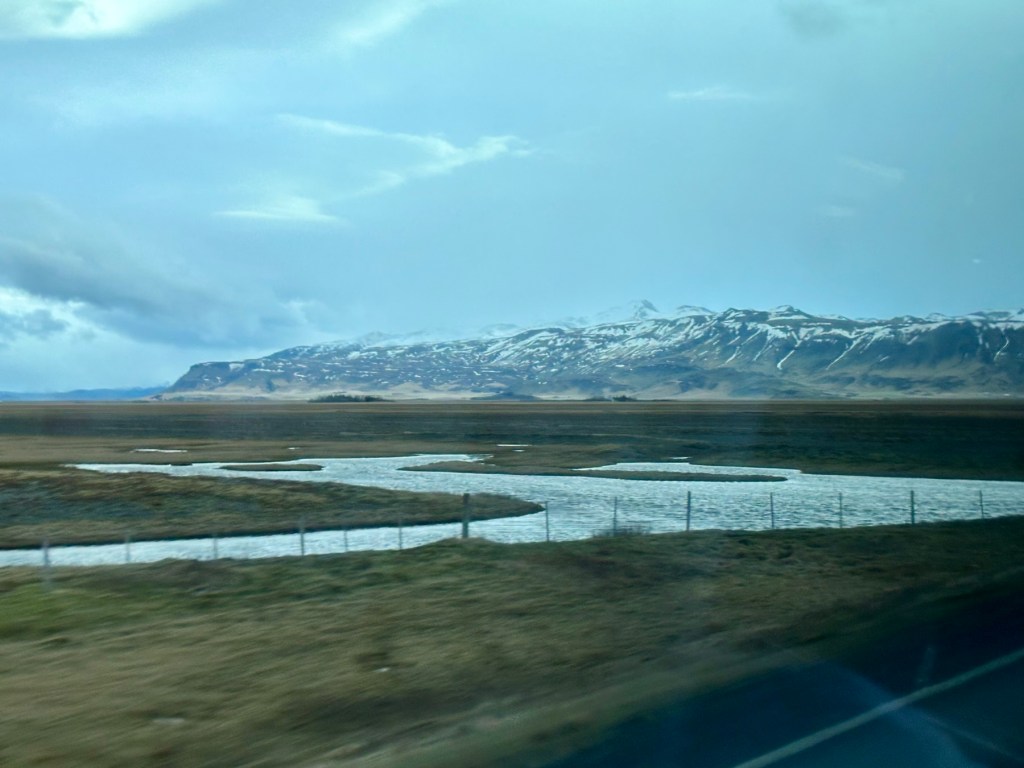
Leaving early from the city centre we were heading out on Route 1, the island circular road that encompasses the island, we will be heading south for approx 2.5hrs towards Reynisfjara beach just outside the town of Vik.
From this point on I’m going to post some pictures as written text does not do these places justice.
Reynisfjara beach
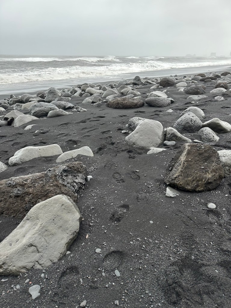

And this video at the black beach sums it all up. It was shot in normal full colour mode but all you can see is black and white, maybe the odd colourful coat or two on passing tourists.
After some time at the beach just drinking in its mystical majesty and getting some fantastic pictures we moved on to the town of Vik, about 20 minutes away to have some lunch. A very pleasant Lamb Stroganoff later we moved on to our next point of interest.
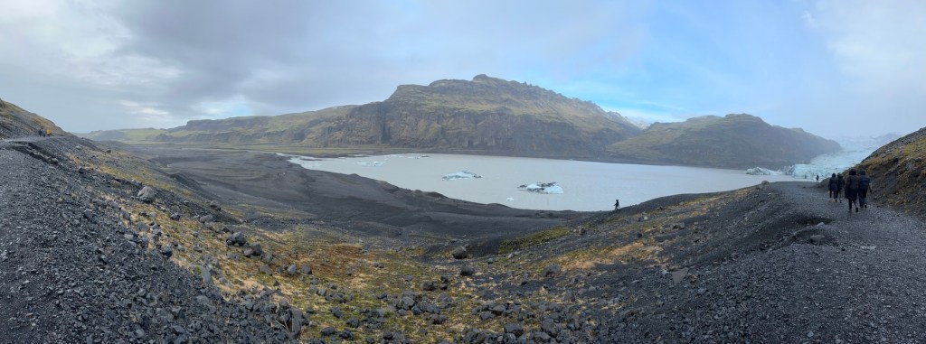
Sólheimajökull Glacier
Sólheimajökull glacier is a perfect example of how global warming is effecting the last remaining glaciers in Iceland, that are retreating year on year at quite an alarming rate. However, it is a beautiful site, what is left. They say that within 150 years there will be no remaining Glaciers on this island.


From here we went on to visit our first of two waterfalls we would be seeing today and this first one has always been one I have wanted to visit.
Skógafoss falls
Skogafoss falls are purely wonderful. With a four hundred plus step climb up to its top you can look down onto the river as it makes its descent to the ground below. It is a magical and most beautiful site surrounded by volcanoes and lush green land. (As the snow has all gone)


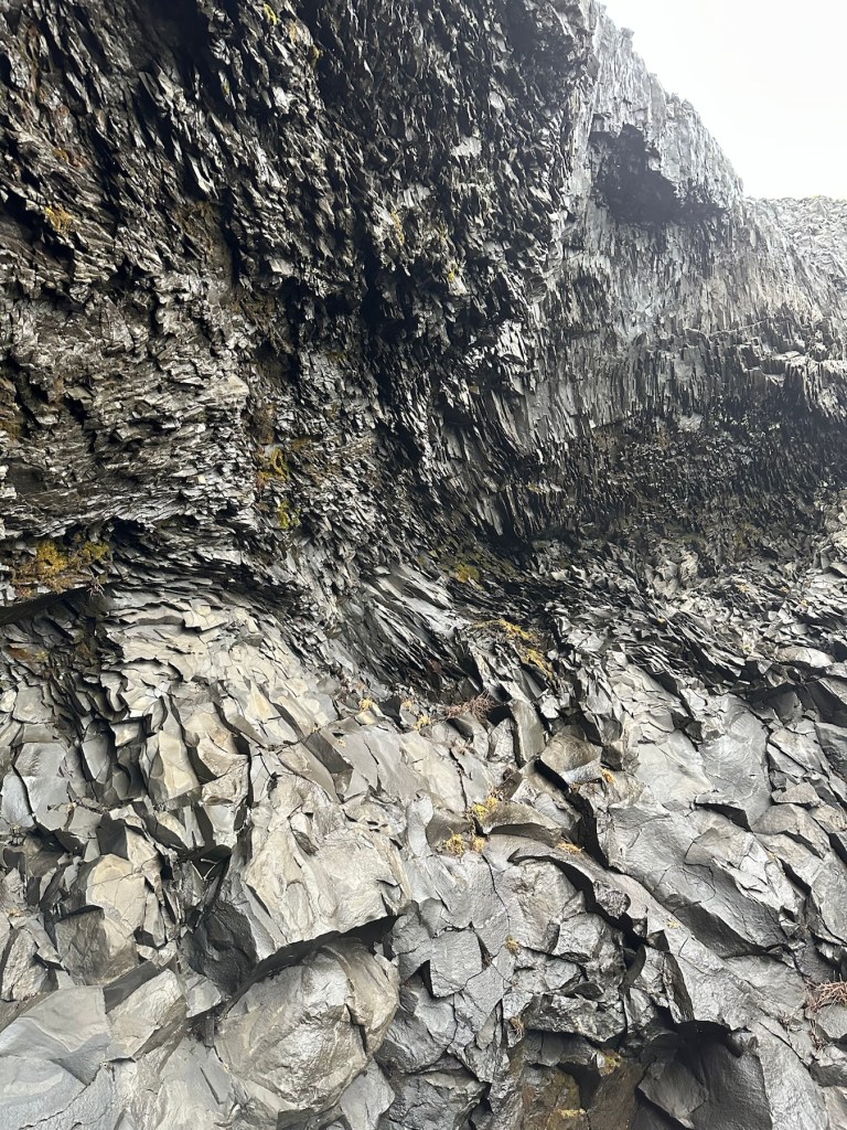
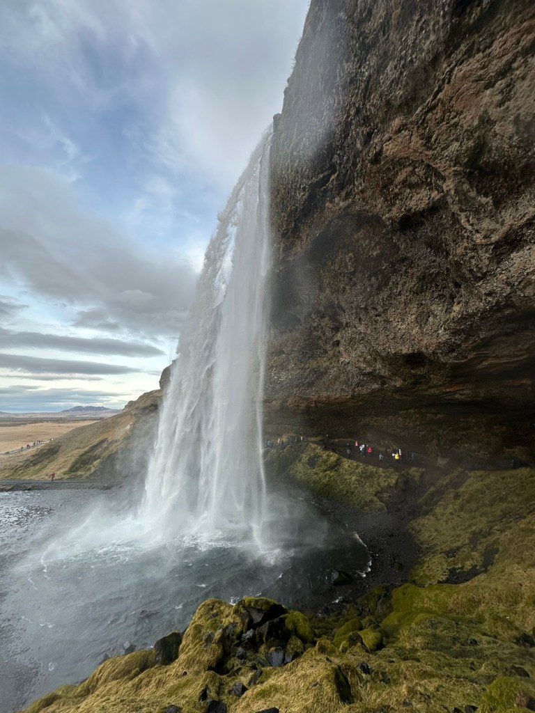
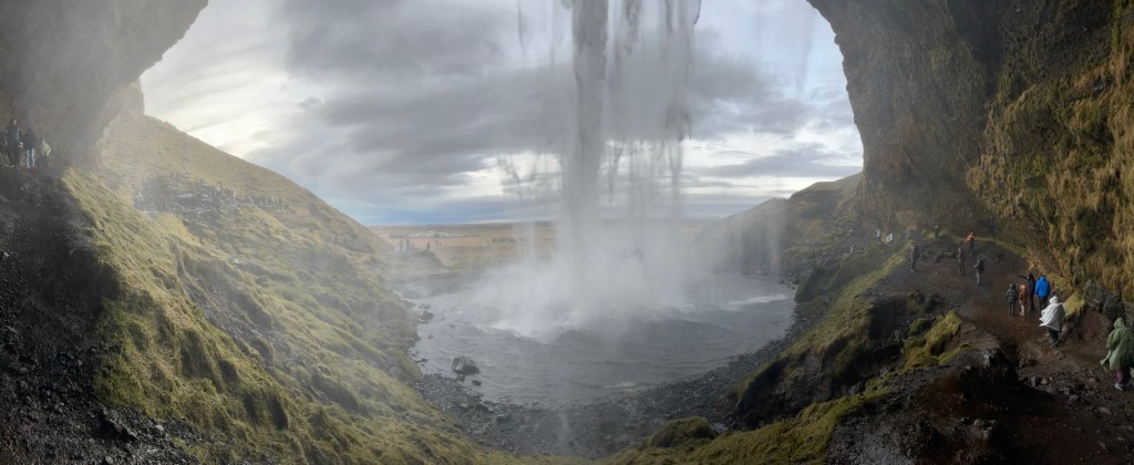
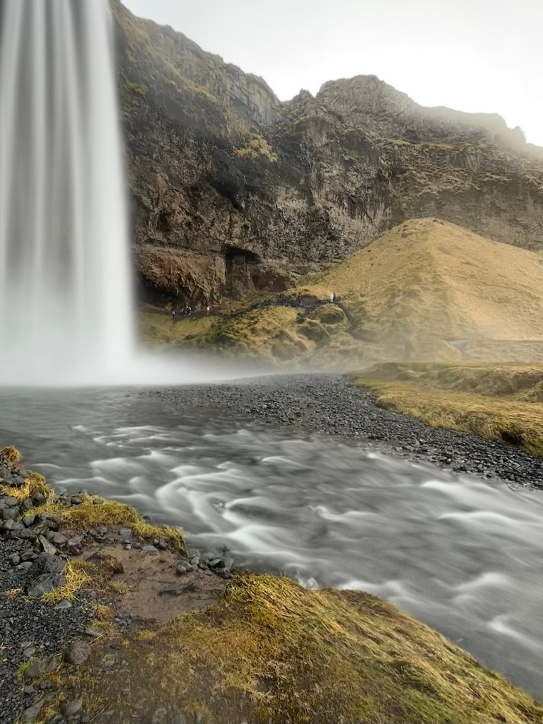
From here we moved on to our second waterfall and last point on today’s trip. This waterfall has a uniquely individual twist to it, you can actually walk behind it if the weather is good enough, and today it was fine. Just be prepared to get wet as it’s a constant mist of water all the way around.
Seljandfoss waterfall
Seljandfoss waterfall is unique. Come take a walk around it.

It’s been a day of pure majesty and scenes of some of natures finest displays of grandeur and beauty. We haven’t even began to scratch the surface of some of the places we can visit here, there is so much more to see and do. And I’m certainly hoping we are back here again soon as we are both still very much in love with this island.
I won’t be posting a day 5 post as that will be a day of recovery from all the walking, some packing and dinner at the Hard Rock Reykjavik. All pretty boring stuff. I will however do a little recap post with some other pictures when we arrive back in the Uk. So thanks for looking in, it’s always appreciated. Back to boring old fixing stuff next week.
Stay safe, peace to all 🙏


You must be logged in to post a comment.